Please note that this page applies only to North Dakota state agencies within the internal state network.
Install Client Software
Before connecting to a GIS Hub database the Microsoft ODBC Driver must be installed on the computer being used to make the connection. The driver is available from the Esri download site, for example:

Define GIS User Types
Define the types of GIS users who will be accessing the SQL Server database. Each person will be in one or more of three Active Directory groups:
- Read-only users (majority of users, used for viewing data)
- Data editors (smaller group of users within the agency, used for deleting/appending data)
- GIS administrators (one maybe two people in the agency, used for creating/delete feature datasets/classes and disconnecting users).
The agency's IT administrator can contact NDIT's GIS Coordinator via Service Now for the names of these groups and to discuss putting individual names or the agency's GIS Active Directory group into these groups. There is also a firewall group that needs to contain the names of the GIS users.
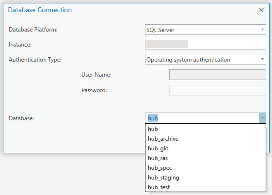
Database Names
ArcGIS Pro can be used to connect to one of the GIS Hub databases. The GIS Hub data reside on multiple databases.
| Database | Comment |
|---|---|
| hub | Primary database, vector data |
| hub_glo | Government Land Office surveys (GLOs) |
| hub_ras | Raster data |
Connecting to a Database
In ArcGIS Pro click on Add Item and select New Database Connection. For example: